
If you are running for pubic office in Illinois –particularly in the Chicago metropolitan area– you can now download political geography maps drawn at the block level showing Latino population percentages in key Illinois House districts, Illinois Senate districts, US Congress districts, and Chicago Wards. If you need geocoding services to plan and monitor your voter outreach campaigns, please let us know.
All maps show approved redistricting plans based on the US 2010 Census. Downloadable files are in PDF format, printable to letter-sized paper. To download the maps, go to our store and, in the search area enter “Chicago wards”, “ward 26”, “senate 1”, etc.
Or, for CHICAGO WARDS, click on the image below:
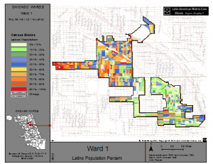
Chicago Wards
Or, for ILLINOIS HOUSE DISTRICTS, click on the image below:
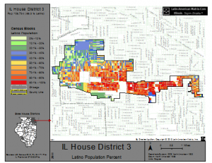
Illinois House Districts
Or, for ILLINOIS SENATE DISTRICTS, click on the image below:
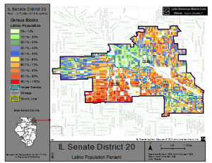
Illinois Senate Districts
Or, for Illinois' US CONGRESS districts, click on the image below:
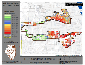
US Congress Districts


Leave a Reply
You must be logged in to post a comment.